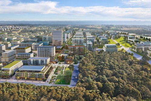
The Orchard Hills precinct is part of the NSW Government’s plans to enable the delivery of more new homes and jobs, close the transport, services and public spaces in Western Sydney.
The draft Stage 1 Rezoning Proposal and draft structure plan for Orchard Hills was available for public feedback between 31 October 2024 and 6 February 2025. Thank you to the community and other stakeholders who provided their feedback on the draft plans for Orchard Hills.
The draft Orchard Hills Stage 1 Rezoning Proposal is focused on rezoning land around the new Orchard Hills Station.
The draft structure plan provides the future zoning intent for land in Orchard Hills located outside of Stage 1. The structure plan will not rezone land. It will guide future planning decisions for the remaining stages and provides landowners with information about what Orchard Hills will look like in the future.
The Department of Planning, Housing and Infrastructure (the Department) has reviewed the community feedback received during the exhibition of the Stage 1 Rezoning Proposal.
After careful consideration and further technical work, the Department has decided to reduce the size and scale of the Rezoning Proposal and a revised proposal will be exhibited in February 2026.
We will provide a further update in early 2026 with details on how you can view the revised plans and provide feedback ahead of finalisation.
For more information on the Orchard Hills precinct, please visit the Department’s website.
Maps
Maps
Several maps have been developed to help you understand key aspects of this Rezoning Proposal including the precinct and stage boundaries, proposed land zoning and proposed building heights. Further information can be found in the exhibited documents located below.
- Aerial plan with Precinct and Stage 1 boundaries – This map shows the boundary of the wider precinct as well as the Stage 1 area
- Draft Structure Plan – This map shows the wider Orchard Hills precinct, including the zoning intent for areas outside of Stage 1 and the proposed land uses within Stage 1
- Draft Indicative Layout Plan – This map shows the proposed land uses in Stage 1
- Draft Stage 1 Zoning Map – This map shows the proposed new land-use zonings for land within Stage 1
- Draft Stage 1 Building Height Map – This map shows the proposed new building heights for land within Stage 1
- Draft Stage 1 Land Reservation and Acquisition Map – This map shows the areas that could be acquired for future roads, parks, a school, drainage and electricity infrastructure within Stage 1
Exhibited documents
Exhibited documents
- Explanation of intended effect for the rezoning of the Stage 1 land
- Urban Design Framework for the rezoning of the Stage 1 land and the Orchard Hills Structure Plan
- Draft Development Control provisions
- Infrastructure in Orchard Hills
- Preliminary Local Contributions Background Report
- Utilities and Servicing Strategy
- Social Infrastructure and Open Space Needs Assessment
- Transport Management and Accessibility Plan
- Integrated Water Cycle Management Report
- Flood Impact Risk Assessment
- Economic and Housing Feasibility Study
- Biodiversity Assessment Report
- Riparian Corridors Assessment Report
- Riparian Vegetation Management Strategy
- Preliminary Site Investigation (Contamination) Report
- Air Quality and Odour Assessment
- Noise and Vibration Report
- Strategic Bushfire Study
- Aboriginal Archaeological Assessment
- Non-Aboriginal Heritage Assessment
- Proposed Statutory Maps
- Land Capability Report
- Aboriginal Engagement Outcomes Report
